EDWIN X BERRY
Work with Desert Research Institute at University of Nevada,
Reno, 1965-1972
RETURN TO ED BERRY HOMEPAGE Discovery Channel Article about cloud seeding in China - April 2008
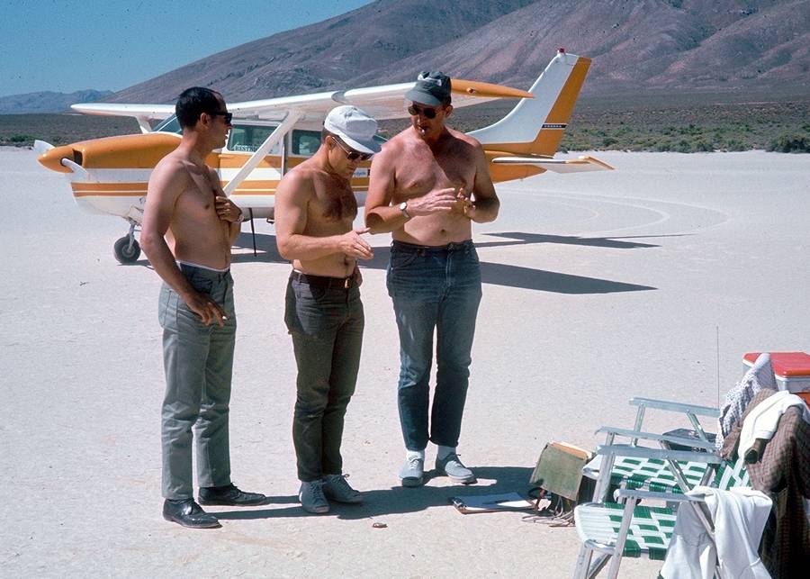
Ed received his PhD in Atmospheric Physics at UN Reno in June 1965 and then worked for the UNR Desert Research Institute. Ed, center, explains the photo next to the Cessna 206:
|
Tom (green hat) always smoked a cigar when piloting. We had a joke about
the time we hit such violent turbulence in roll cloud conditions that our C-45
almost flipped upside-down ... Tom had to put his cigar in his mouth and fly
with both hands. My job was to always dream up fun projects like this. Their job was to go along for the ride and share the fun. Then we had to write a report to make it all legal. |

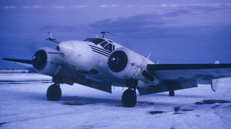
The DRI owned a Beechcraft C-45 (an old WW-II plane), shown below at the Idaho Falls airport, which was home base for our Yellowstone flights. The airport runways were slick ice. I don't know how Tom Wells managed to land the squirrelly C-45 on slick ice without sliding off the runway. But Wells was a real pro pilot. Without him, the crew would have died many times over.
|
Ed recalls this event in the Beechcraft with Tom Wells at the controls: We were flying west over the Sierra at about 14,000 feet in a winter storm. We hit severe icing and started loosing altitude. There are mountain tops at 10,000 feet. We can see nothing. Wells turns immediately and tries to get back to Reno. We are losing altitude fast and he determines if we continue we could end up parking on Slide Mountain. Wells also knew before any of the crew figured it out that once we got below about 10,000 feet we would lose contact with our Vortac we were using for position reference. He quickly figures out our best chance is to circle over Lake Tahoe to assure we keep away from mountains and because clouds rarely sit at water level so we should have some visibility in case we have to land in the lake. Wells told me later if this were the case he would have attempted to come in and skid across the water just enough to slip up onto a beach, and I have no doubt that Wells was fully capable of pulling off such a stunt. Meanwhile, Wells was figuring out a way to circle over Lake Tahoe and stay over the Lake when we lost contact with the Vortac. Wells set up a race track pattern along the wind direction over the Lake. With this pattern he determined how many seconds he needed to fly upwind versus the second downwind in order to maintain a ground position. This is a nice textbook thing in pilot manuals but it take a real pilot to accomplish this in life threatening circumstances. We lost Vortac contact. Only Wells knew where we were. 9000 feet, 8000 feet, 7000 feet. Still in the cloud and well below the mountain tops around the Lake. One miscalculation by Wells and we would have become statistics in a split second. 6400 feet we break below cloud base over Lake Tahoe. Lake Tahoe never looked so good. With visibility Wells flew towards the west shore where he could use his beaching plan if necessary. The plane held altitude at 100 feet over the Lake. The ice melted off. We had enough fuel to make it to Reno. Wells headed west and upward into the cloud picked up the Reno Vortac and descended into Reno on instruments and landed safely at the Reno airport. |
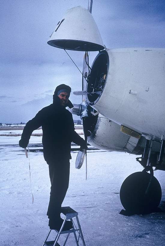
Ed loads the camera and other instruments in the nose
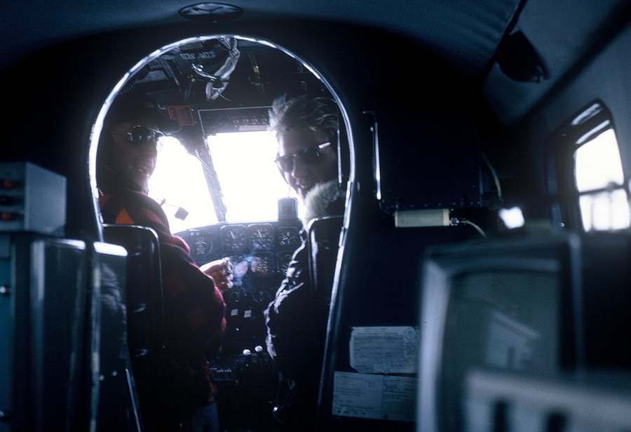
Tom Wells at the controls, cigar in hand. Co-pilot is Klaus Neilson, originally from Denmark. Klaus took Ed for his first sailplane ride from the dry lake west of Stead AFB, which got him interested in taking sailplane lessons.
While not part of the formal "mission," they decided to fly through Old Faithful Geyser. On the movie film which will be digitized is a record of the flight. On one pass through Old Faithful the camera shows them lower than the roofline of Old Faithful Lodge which is to the left in this photo. If you are ever at Old Faithful Lodge take a look at the roofline and imagine a rusty old former Air Force plane flying through Old Faithful lower than the roofline. Ed doubts that any other such footage exists.
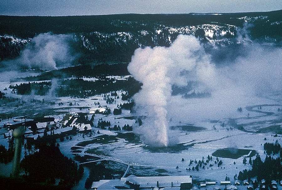
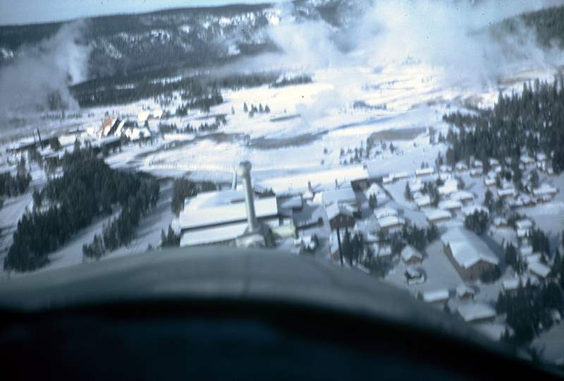
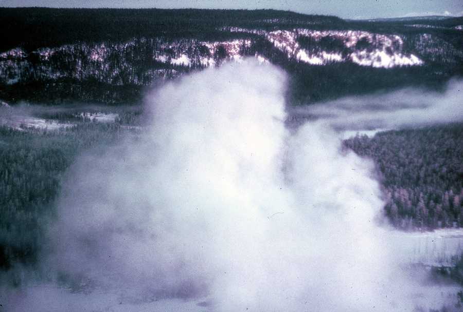
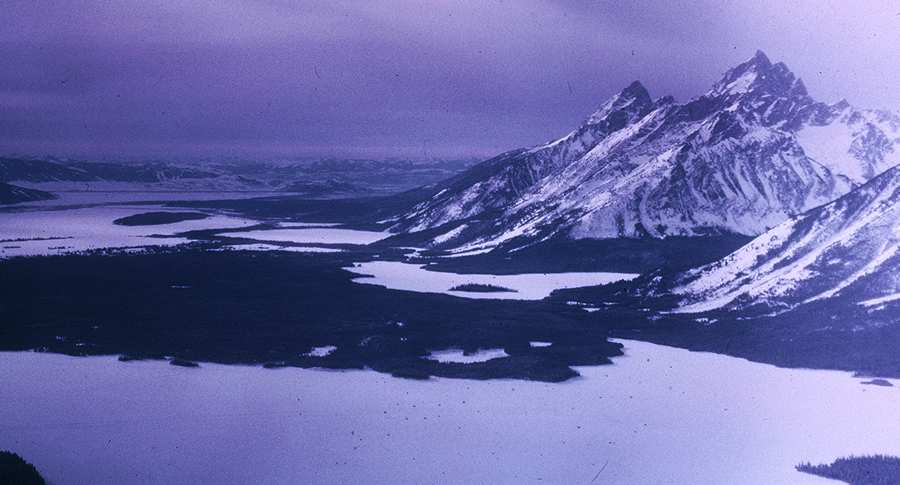
Here is some scenery
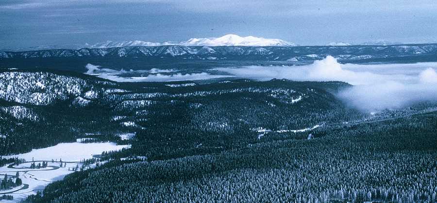
Photo from a loop south to see the Grand Tetons:
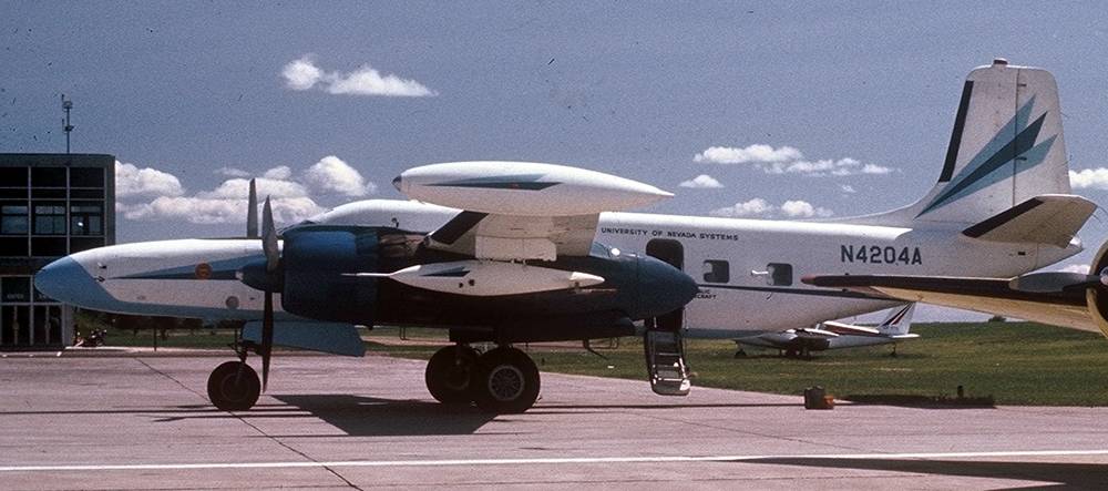
In 1968 the DRI upgraded to a customized 1944 Douglas B-26 - stationed at Stead AFB north of Reno. (In 1969 I took a flight in this plane out of Calgary Alberta into a hurricane on a research mission. I recall a few very strong g-force moments.)

Larry Rea and Paul Lage (orange sweater) loading silver iodide and flares on the wing pods
|
Ed explains the wing pods: Those wing pods were a lot more than flare holders. They originated a whole new way to instrument an aircraft. All prior instrumented aircraft had the instrumentation specially built into the plane. Instrumentation in those days was analog and took a lot of calibration and debugging. When the instrumentation is built in then the technicians must do all their calibration and debugging inside the aircraft. It was slow and tedious and usually did not work. I changed all that by having the technicians, headed by Paul Lage shown in the orange sweater alongside Larry Rea, build everything in the lab rather than in the aircraft. There was the electronics package in racks that could be quickly mounted on the floor inside the aircraft, the instrument sensors mounted on the two pods made from former fuel tanks, and the cabling between them. The trick was to have the technicians build two exact copies of the cabling: one for the lab and the other for the aircraft. When the two cabling units were fully calibrated, one of them was installed in the aircraft running from the cabin to the instrument pods. The other remained in the lab to be used for calibrating and debugging the instruments. It worked like a charm. When ready for a research flight, we simply moved the package and the pods from the lab to the aircraft. We never had an instrument failure during any flight. The weather radar is the first ever aircraft radar to paint a picture referenced to the ground, and this was long before GPS made it easy. We would make a copy of a sectional map on clear plastic and mount the plastic map over the storage scope shown here. We used a local Vortac as a point of reference. We could dial the position of the Vortac on the scope and then position the map. Then our analog computers would add aircraft heading to the radar angle with respect to the aircraft to get north orientation. Then our analog computers would add our position according to the Vortac and put the north orientated radar signal on the scope. Viola, a ground position radar. Finally, we could keep track of our position with respect to clouds. We could seed a cloud and fly back into the area we seeded. We could watch clouds moving. This was my own invention. I helped the Air Force use this concept for their hurricane monitoring. They had been using rotation radar antennas on top of aircraft to look at the hurricanes, thinking they needed to rotate the radar to get a picture. Add a piece of information: the larger an antenna the better the radar image. The problem then is how do you put a larger antenna on an airplane and still fly the airplane. Simple. Replace the large door on the side of a C-130 with a radar antenna mounted behind a new door made of radar dome material. Now, to get a picture of a hurricane simply fly a 360 circle and use ground positioning of the signal, like we did on the B-26, to paint a ground referenced high-resolution picture. It worked like a charm and produced the finest hurricane radar picture ever at that time. |

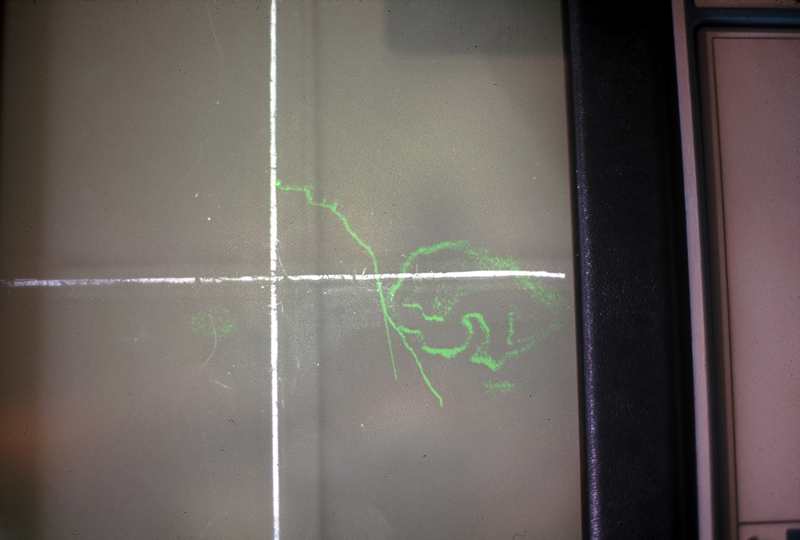
This is the on-board radar of weather patterns that Ed would monitor in flight.
|
Ed explains the radar: The photo shows our radar picture of an Alberta hailstorm. Not a hurricane. The radar image shows lines rather than fully painted areas because our instrumentation was taking derivatives of the pattern to show outlines of similar echo regions. The indention into the cloud on the south was the "weak echo region" of the storm. It is known as the strong updraft that feeds the storm. We flew by this area outside the cloud to see what it looked like. I took a photo of the big hole in the cloud as we looked into this weak echo region. It was rotating and I imagined it to be like looking into the bottom of a tornado. We did not have the nerve to fly into the hole. We all voted No. Like no way baby. We wanted to live to see another day. Hailstorm flying is dangerous. If one flies into large hail it can damage the airplane and cause it to crash. The nose radar on an airplane cannot be counted on to see the very large hail because the hail may be coming down at very fast speeds. A radar might have to look up at an angle of 30 degrees in order to see large hail converging into the path of the plane. However, aircraft radars, at least then, were limited to looking up at 15 degrees. So when we flew into the hailstorm we counted on Dr. John Marwitz of the University of Wyoming, who was monitoring the ground based radar, to warn us if he saw any strong echoes above a path we planned to take through the storms. This coordination and professional help was critical to atmospheric research experiments in hailstorms. |
In March 1980 the plane went down between Lake Tahoe and Sacramento. Ed no longer worked for DRI. All four crew died in the crash. Crash reports are unclear whether icing or mechanical breakdown caused the crash.
Ed states: I am convinced the B-26 went down because of ice
for two reasons. First, we encountered icing on a few of our flights through
Sierra Nevada winter storms. I know how the B-26 can be overwhelmed by ice. Its
inflatable boots on the wing leading edges were not able to remove ice as fast
as it can build up. In both the B-26 and the C-45 we hit ice that caused loss of
altitude. We could have crashed. It was dangerous work. Tom Wells always had a
plan that saved us for another day. He had a way of following the low terrain
when we could not maintain altitude until we were low enough so the ice would
melt.
The second reason is the report of an eye witness to the crash. He said the B-26
rolled over as it came out of the cloud. This is caused by having ice. Ice
increased the stall speed and ice can break off one side before it breaks off
the other side. When ice is bring a plane down any attempt by the pilot to pull
back the elevators too much can cause the plane to stall. In icing it is very
likely one wing will stall before the other wing. This would cause the plane to
roll, as reported by the witness.
CRASH REPORT14 CFR Part 91 General Aviation Event occurred Sunday, March 02, 1980 in GEORGETOWN, CA Aircraft: DOUGLAS B-26C, registration: N4204A
----------------------------------------------------------------------------------------------------------------------------
Originally known as 1944 Douglas A-26C-40-DT Invader
L.B. SMITH
- Conversion from military to corporate aircraft |